

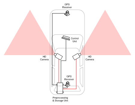
The Mobile Data Collection Unit was developed and used by GEODATA. It is a vehicle equipped with high definition cameras, GPS receivers and other devices, which – managed exclusively by its driver – collects a continuous image from the surrounding area as it moves.
The material obtained from the footage taken along a road axis provides the ability to extract multitude of data with exceptional accuracy and speed, such as: street names and numbers, prohibitions, signals, points of interest and other useful data.
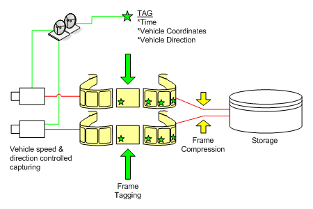
Each collected frame is marked with time, coordinates and direction of the vehicle and is stored compressed on both sides of the road as the vehicle moves.
At the office, the material is transferred to a central system from where it is retrieved through a special application and the required information is indexed.
The main advantage of this system is the ability to reuse the recorded material for future data mining, and of course the speed with which the actual recording of data can be performed by many workstations simultaneously, and in office conditions.